
GLASWEGIANS like to think their city is unique.
Yet it has acted as an on-screen substitute for Philadelphia (Brad Pitt’s World War Z), New York (the forthcoming Indiana Jones film) and many other American cities.
One reason for this is the city centre’s grid-iron street plan, which resembles many in the US. How did Glasgow, much older than these carefully planned American upstarts, come to be laid out in a similar way?

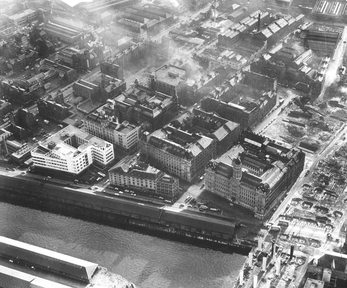
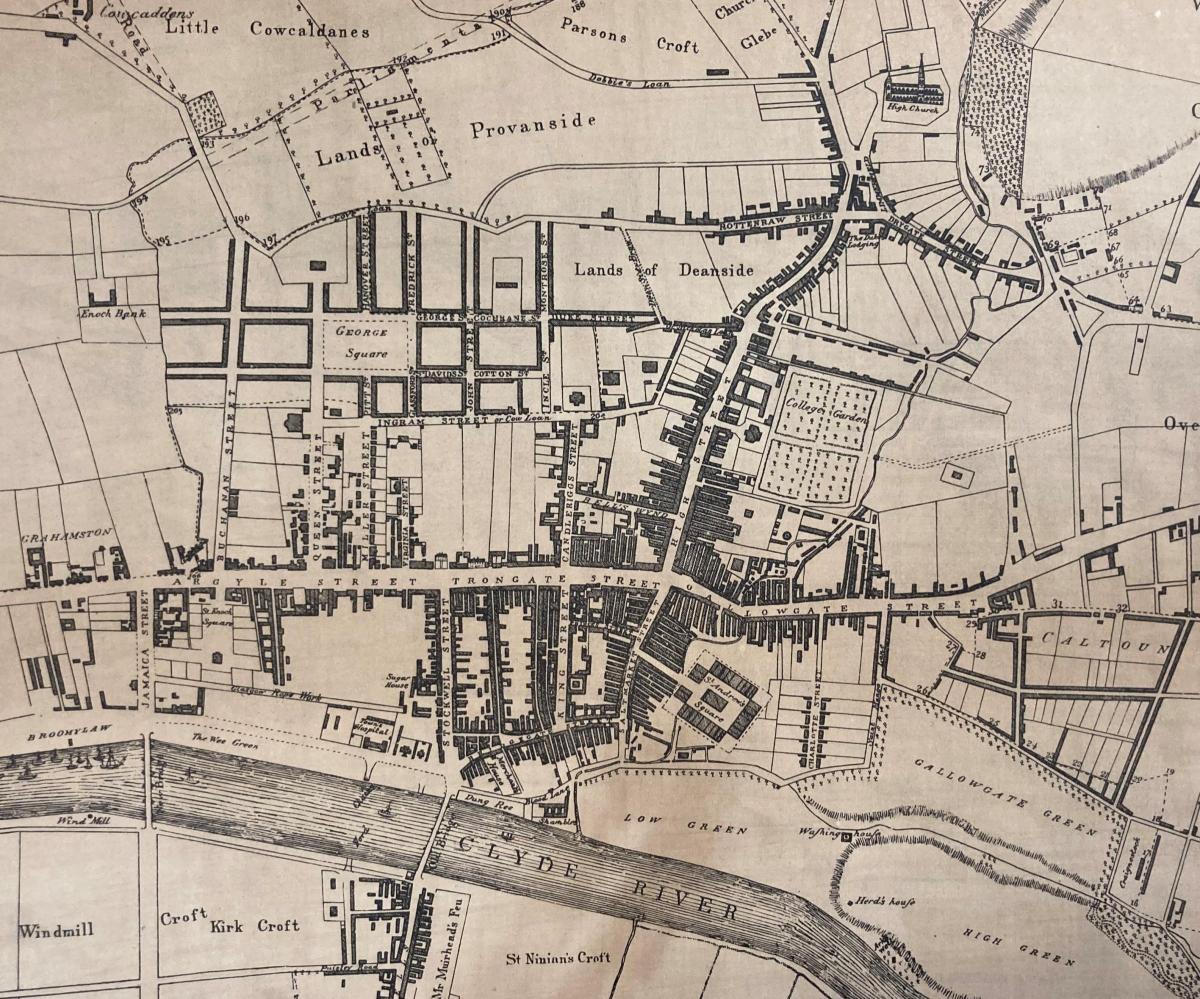
Medieval Glasgow was a small town of two clusters – one based around the Cathedral and another around Glasgow Cross. In the middle of the 18th century, it began to expand around the crossed axes of its two primary streets: the High Street and Argyle Street/Trongate.
These straight lines provided the basis for the city’s development. The area we call the Merchant City emerged next. One of the earliest general plans of Glasgow - a survey by John McArthur in 1778 - shows this space beginning to be filled up.
READ MORE: Remembering the world famous Glasgow concert hall destroyed by fire
Shortly afterwards, in 1782, the surveyor James Barry produced an updated plan which included the thoroughfares of Queen Street and Buchanan Street leading toward the new George Square, with a network of streets running along each side. A clear lattice pattern was beginning to emerge.

With the basic framework established, the city could expand westward and what happened next confirmed the grid as a quintessentially Glaswegian configuration.
Just to the west of the city centre lay the 470-acre Blythswood estate which was owned by the Campbell family. By the end of the 18th century, Archibald Campbell decided that the time was right to maximise income on his family’s land. He took the decision to feu off the estate - a distinctively Scottish form of land transfer which means the feudal superior (the Campbell family and its trustees) was paid an annual fee but retained ultimate ownership.
This proved lucrative: within 50 years the family’s rental income increased from £223 to £25,000. More importantly for the city however, the peculiarities of the feudal system meant that the family could still set out the planning and architectural constraints under which development could take place. They established rules for the width of streets and height of properties which meant that things were controlled, initially at least.
READ MORE: Glasgow archives reveal history of city's famous clock towers
Most of the land was sold off in rectangular parcels. As a result, a clear grid pattern emerged on the Blythswood lands, bounded by Sauchiehall Street to the north and Argyle Street to the south, and shown on a map by the architect James Gillespie in 1820. By this point, the pattern was locked in. The City Archives holds the Blythswood estate papers (including this map) which reveal how this distinctive part of Glasgow’s landscape came to be.
What is interesting about the spread of the Glasgow grid - compared with Edinburgh’s New Town, for example - is that it was not part of an overall civic plan, but a series of private developments. It grew almost organically, partly as a practical solution to the city’s topography. This makes its coherence quite remarkable.
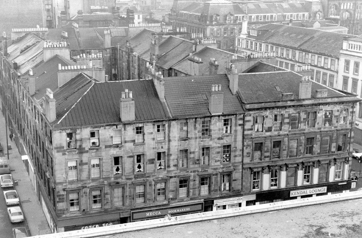
After Blythswood, this spatial order was exported piecemeal to many of the new suburbs such as Hillhead, Kinning Park and Govanhill, at least in part. Tenements formed the basic building blocks of the city at this time and the structure of blocks, courts, flats and closes lent itself well to the confines of the grid and gave Victorian Glasgow much of its character.
A city that grew around a grid might sound like a dull and monotonous place, but Glasgow retains enough variety to make it architecturally and stylistically interesting. Even the grid itself is far from boring. Whilst Gillespie’s 1820 map of Blythswood might suggest a flat landscape reminiscent of countless American towns, it doesn’t account for the three-dimensional aspect – hills! Anyone who has tried to scale the slopes around Blythswood Square will be aware of how much these impact the landscape.
Glasgow may not have been the first city to be laid out around a grid, nor the biggest or most significant, but all these factors help make its effort special.


Comments & Moderation
Readers’ comments: You are personally liable for the content of any comments you upload to this website, so please act responsibly. We do not pre-moderate or monitor readers’ comments appearing on our websites, but we do post-moderate in response to complaints we receive or otherwise when a potential problem comes to our attention. You can make a complaint by using the ‘report this post’ link . We may then apply our discretion under the user terms to amend or delete comments.
Post moderation is undertaken full-time 9am-6pm on weekdays, and on a part-time basis outwith those hours.
Read the rules here