




“That prince of measurers…who first made measuring a fine art in Glasgow”.
This pleasing moniker and generous praise were in honour of William Kyle, Glasgow’s first land surveyor and founder of the city’s longest-running firm of land surveyors, Kyle & Frew.
In this week’s Glasgow City Archives column, archivist Barbara McLean delves into the collections to find out more about the man responsible at least in part for the origins of the city’s distinctive grid street pattern.
William Kyle established his business in around 1778 at a site on Great Hamilton Street. His premises were just east of Glasgow Cross and were part of the city’s business centre.
However, as Glasgow expanded to the west, he followed suit and moved his business to Kent Street in Anderston.
At this point in time, Kyle was the sole land surveyor in a town with a population of around 50,000 people and which was then surrounded by privately-owned estates.
During his career, Kyle was commissioned by Glasgow Town Council to act as its land surveyor on several occasions, including work on the river Clyde navigation.

He served the Town Council during the approximate period of 1802 to 1835. One of his duties was to “perambulate” (from the Latin meaning to walk completely) the Glasgow town marches once a year, along with the Provost and Magistrates. The marches were the boundaries of the town and the group physically walked along them to mark out the town council’s territory.
We hold a few of his surveys at the City Archives, in the maps and plans section of our Glasgow Corporation Town Clerk collection.
One particularly interesting survey of 1805 is entitled Clyde Street Improvement, and focuses on a general plan of the city and Glasgow Green from Stockwell Street to Nelson’s Monument.
The survey itself shows the planned new Justiciary building with all its ground floor apartments named. These included the Room for Witnesses, the Room for Enclosing Jury as well as the Debtors and the Felons’ Galleries and Sleeping Rooms.
Kyle’s professional expertise was also sought after by private families with landed estates. He acted as the land agent for the Campbell family who owned the 470-acre Blythswood estate to the west of the city centre.
READ NEXT:
-
The strange rules Glaswegians had to follow to use wartime air raid shelters
-
Memories of Glasgow's famous Modern Homes Exhibition at the Kelvin Hall
-
This Glasgow building is one reason city can double for New York in the movies
We hold the historic records of this estate and some private papers of several family members as part of the City Archives collections.
The family began to feu off the Blythswood Estate at the beginning of the nineteenth century. Feuing was a type of Scottish land transfer whereby the feudal superior (in this case, the Campbells and their trustees) was paid annually by the purchaser but remained the overall owner of the land.
Under this system, the Campbells were able to control the planning and execution of developments on their former estate, down to the width of the streets and height of the properties to be built.

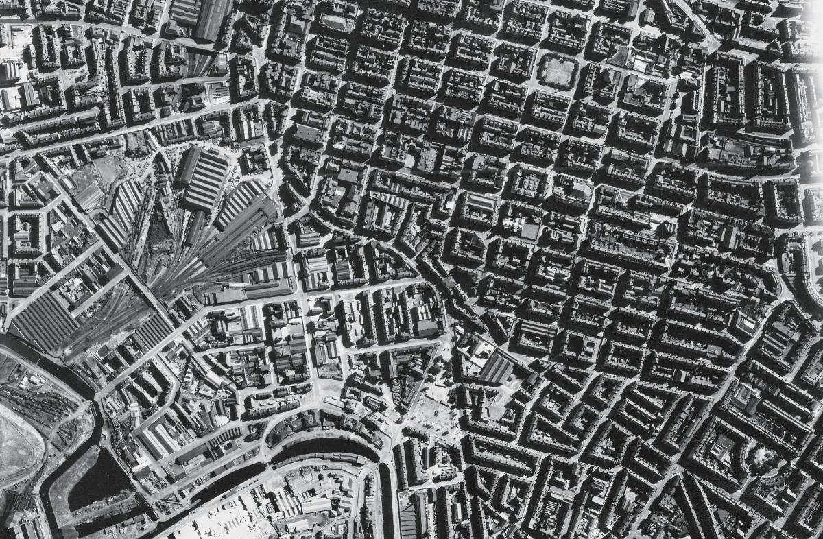
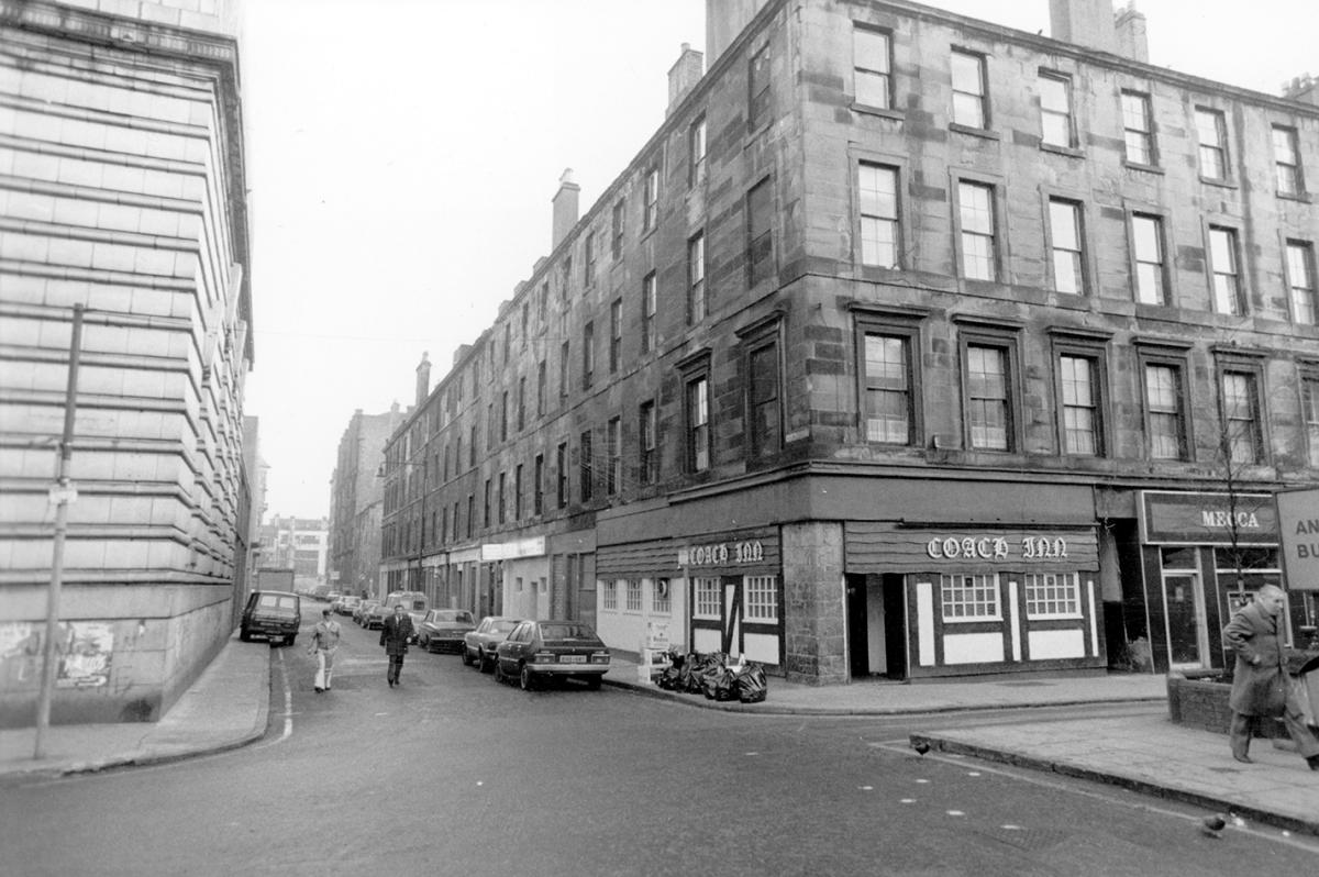
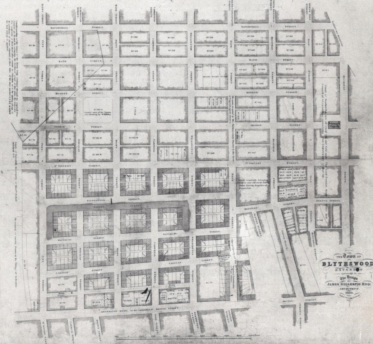
As the land was feued in rectangular areas, an orderly grid pattern of streets was created. This is illustrated by an 1820 map, drawn up by the architect James Gillespie and held as part of our Blythswood Estate archives collection. This photograph showing the Coach Inn at Holm Street in around 1970 also illustrates a small part of this grid pattern.
As part of Kyle’s work for the family, he drew up a plan book of individual feus given off from the estate during 1802 – 1803. This became a permanent record of all the new developments within the area. As a firm, Kyle & Frew provided more than a century of service for the Campbell family which is reflected in the plans which have survived to form part of their archives held here.
The firm became a family business when William Kyle’s nephew, Thomas, and his cousin, John Frew, became apprentices in 1829.
They were the latest students in a training school established by William Kyle in around 1795, which taught the art and science of land surveying.
Thomas Kyle became a renowned land surveyor in his own right and many of his plans survive in our collections as well, not least in the records of the firm itself.
The collection comprises plans, registers and correspondence, and is part of the legacy of a founder whose own professional career lasted for more than forty years.


Share